June 2026
A new DDHS exhibition will open on 26th June 2026. Below are some panels from the exhibition. Initial text by Pauline Smeed and place-names explanations by Liz Curtis. Links added by Dr James Herring.
Dunbar?, Lamer Street?, Friarscroft? Our volunteers in the Town House are often asked ‘what does it mean?’, ‘where did the name come from?…
Our latest exhibition, opening on 26th June, 2026, is based on the online publication, ‘Place-names of East Lothian: A journey through time’, researched by Dunbar & District History Society member Liz Curtis. The exhibition presents a selection of names from North Berwick to Dunglass and is supported by artefacts and historical images.
As Liz explains, ‘over thousands of years, a succession of different peoples arrived in East Lothian, mostly seeking the excellent agricultural land. They spoke different languages – Brittonic, Old English, Old Norse (Scandinavian), Gaelic, and Norman French. Then Scots developed locally, based on Old English. Each group named the land in their own way. They adopted the place-names of their predecessors or adapted them or created new names. As a result, East Lothian has a wonderfully varied collection of place-names, which illuminate our history.’
The full version of the online publication can be found on the Scottish Place-Name Society’s website, https://spns.org.uk
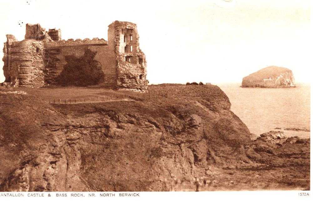
TANTALLON
Recorded as dentalonne in 1335 x 1366, this is possibly ‘fort on the brow or headland’ from Brittonic dīn ‘fort’ and *tāl-an ‘brow place’. Tantallon today is a massive ruined medieval castle on a promontory where the Firth of Forth meets the North Sea. It was probably built on top of a prehistoric promontory fort similar to that at Dunbar, which would explain the name.
You can read more about Tantallon Castle on the HES site (god photos) which describes the castle as Set high on a cliff edge and featuring a massive red sandstone curtain wall, Tantallon Castle was home to the Red Douglas dynasty.
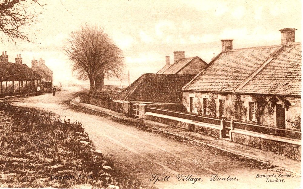
Spott
Recorded as Spot in 1153 x 1159, this is from Scots spot ‘a small area of land’.
You can read more about Spott Village’s history here as well as a feature on Spott Kirk on Undiscovered Scotland (good photos). The postcard indicates that it is from Sanson’s series. Frederick George Sanson was a notable late-19th to early-20th-century local photographer and draper from Dunbar. His photographs showed aspects of Dunbar at the time e.g. the High Street and the harbour. DDHS has a large ccollection of Sanson postcards in its archives.
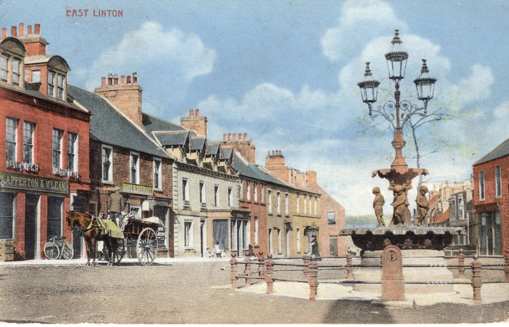
East Linton
This settlement was recorded as Lintunin 1127, which means ‘farm by the torrent’, from Old English tūn ‘substantial farm’ and hlynn ‘torrent’. The hlynn is the waterfall which tumbles over what are now called the Linn Rocks. By about 1840 the village had become known as East Linton, to distinguish it from Linton in Peeblesshire, now known as West Linton.
You can read detailed accounts relating to a number of aspects of East Linton’s history e.g. agricultural heritage or artistic heritage on this site (good photos).
You must be logged in to post a comment.