June 2025
This month, we are going back to 1832 to look at part of a document relating to the Reform Act of 1832. The booklet was donated to DDHS by Pam Murray and previously owned by her father George Low. Text and links by Dr James Herring.
The National Library of Scotland tells us that the 1832 Reform Act represented an important shift of power from aristocratic and landed interests to the growing urban middle-classes and those house owners with property valued over £10. Thus while many more people could vote, it was still the respectable classes who were enfranchised. It was not until 1918 that universal suffrage came about. We need to remember however, that only men could vote and that women did not get the vote until 1918. Also, women over 30 could vote and 1928 before women over 21 could vote. The photo above shows the cover of the booklet, published by Historical Discovery. The introduction tells us that the bill for the Act was only passed with the creation of 50 new peers in the House of Lords. It also states that in England, The victory was seen as a modern version of Magna Carta and also that the Scottish seats which had amounted to virtually one huge Rotten Borough, were transformed at a stroke.
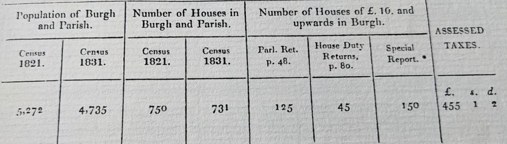
There is a one page description of each town and Dunbar has One spacious Street [which] extends nearly the whole length of the Town, with two others running parallel to it. In addition, the chief article of Trade is Fish, particularly Herrings, of which, in some years, a great number are caught and cured for Exportation. There is a Soap-work and an Iron Foundry. You can read more about the iron foundry here. The photo above shows a table included in the report and it interesting to note that between 1821 and 1831, the population fell from 5272 to 4735 and the number of houses in the town fell from 750 to 731, suggesting that some demolition of housing took place at this time. Dunbar’s population remained fairly steady until the 1960s, when what was locally called the Glasgow Overspill came to the town. It is only very recently that the population has gone over 10,000 (and rising). The Special Report with an asterisk, was obtained from Mr W.H. Ritchie, the Town Clerk and this puts the number of houses worth £10 or more as 150. Today £10 is equivalent to nearly £1500, a paltry sum by today’s standards.
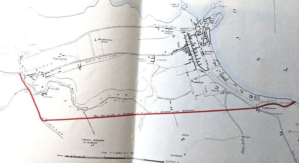
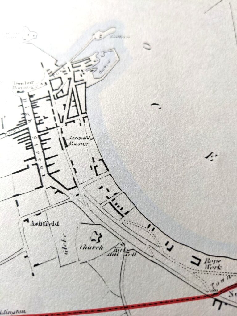
The first map above shows the complete map of Dunbar displayed in the booklet and the boundary lines are noted to have been drawn up in straight lines. The map immediately above mainly shows the High Street but includes the Assembly Rooms (good photos), Ashfield (no houses then) the Parish Church and the Rope Works, of which over the years there were two in Dunbar. Below the red line on the right, the map reads Part of Broxmouth Park, Duke of Roxburgh (i.e. with not e on the end). The duke at that time was James Henry Robert Innes-Ker and he was well known for remodelling Floors Castle (good photos and history) with the architect William Playfair (Biography and photos).
You must be logged in to post a comment.