Our first talk of the new season in September was very successful as we had an excellent talk on maps of Dunbar through the centuries by map expert Paula Williams, from the National Library of Scotland’s map library on Causewayside in Edinburgh. Ms Williams has kindly sent three slides from her talk, with some comments. Additional information and links by Jim Herring.
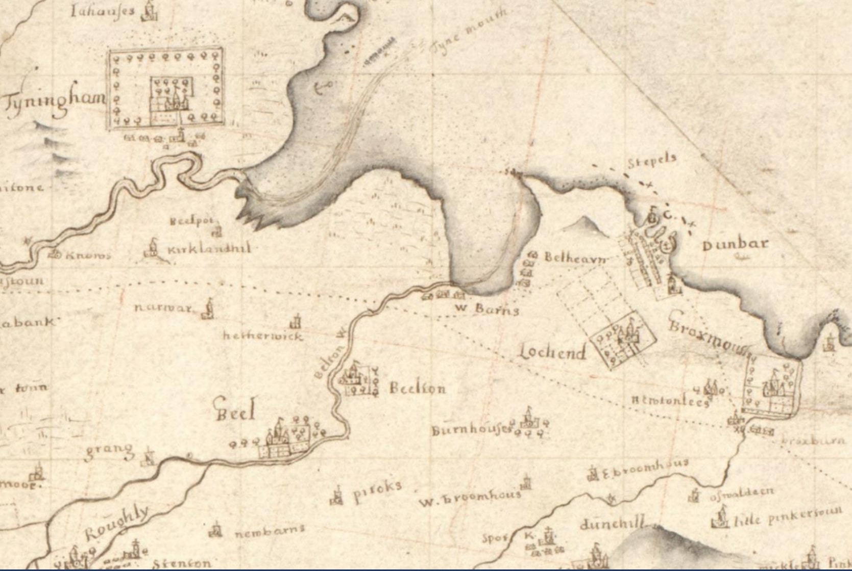
John Adair map 1682
The first map (photo below) is by the surveyor John Adair and is described as 1 manuscript map : hand col. ; 495 x 545 mm., on sheet, 573 x 701 mm. You can look at this map online at https://maps.nls.uk/view/00001015 It’s Latin title is East Lothian / authore Johanne Adair. John Adair was, according to brittanica.com “A Scottish surveyor and cartographer whose maps established a standard of excellence for his time and probably inspired the early 18th-century surveys of Scotland. Between 1680 and 1686 he completed maps of the counties adjoining the River Forth as well as charts of the Firth of Forth, the River Clyde, and the west of Scotland. Manuscripts of these are in the National Library of Scotland and other libraries“. Paula Williams added that “This is one of the earliest maps of the area in any detail. The surveyor John Adair is alleged to have had his arm broken after being stoned by the residents of Dunbar who did not like their town being measured!”. If you enlarge the map, you will see that several places, while still recognisable, have different spellings e.g. beeltoon, dunehill and little pinkertoun.
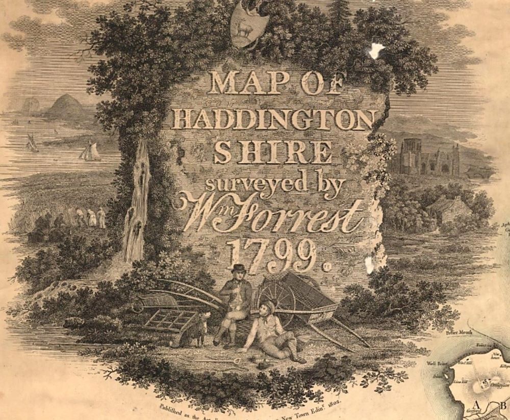
William Forrest map 1802
The second map (photo below) is described as Map of Haddingtonshire / William Forrest. [Edinburgh] : s.n., 1802. 1 map on 4 sheets : col. ; 1206 x 1467 mm., sheets 632 x 743 mm and you can see the map online at https://maps.nls.uk/view/74400256 Paula Williams noted “The title cartouche of this wonderful map of the whole county shows St Mary’s church in Haddington and a rather bucolic view of the countryside around”. Dunbar is not shown on the map beside the illustration but Paula Williams told the audience that maps such as this may have been drawn up for a patron – a wealthy landowner maybe? She also said that “there is no such thing as an unbiased map” as some maps were done for political reasons while others were military oriented. You can see more maps by Forrest here. Little appears to be known about this William Forrest, while his namesake is a well-documented engraver.
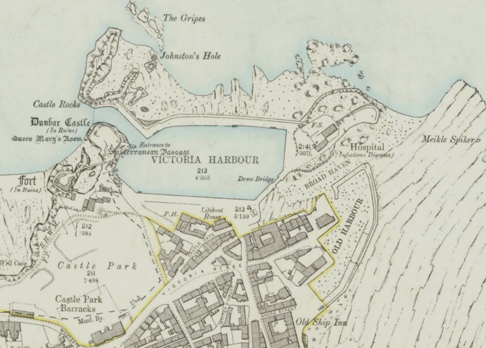
The third map (photo below) is an extract from an Ordnance Survey map and is described as Haddingtonshire VII.5 Revised: 1893, Published: 1894. Size: map 64.4 cm x 96.6 cm (25.344 x 38.016 inches), on sheet ca. 76 x 104 cm (ca. 30 x 41 inches). You can see this map online at https://maps.nls.uk/view/82885338 The map shows the harbour area in some detail. If you click on the map to see the larger version, you will see various aspects of the harbour are highlighted e.g. Johnston’s Hole, Queen Mary’s Room near the castle and down from that Fort (In Ruins). At the top of the map, in the enlarged version you will see The Gripes – a small group of rocks. In more recent times, at the eastern entrance to the harbour, we have The Gripps but these are not believed to be connected. To the right of the harbour, you can see Hospital (Infectious Diseases) and this later became the Battery Hospital, which is described in detail on the DDHS website here. At the hospital end of the harbour, you can see Draw Bridge and the building of this is explained on the DDHS website here.
This was a fascinating talk by Paula Williams, which was followed by several questions and a hearty round of appreciative applause.
You must be logged in to post a comment.