This month, we are going to continue looking at buildings that have either disappeared or changed in some way.

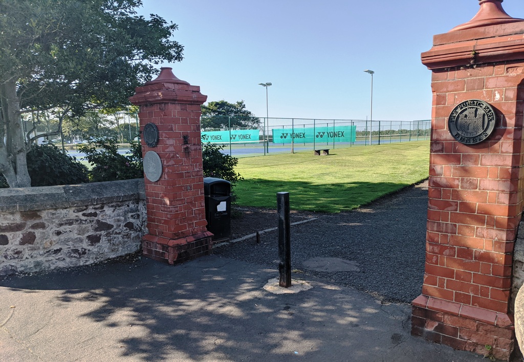
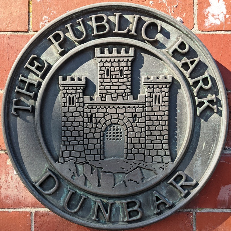
The first photo above shows the entrance to Winterfield Park, in the 1930s. The park was designated as The Public Park in 1920 and was built on land owned by St Clair Cunningham. The third photo shows the name of the park with the Dunbar crest on the front, although there is no date to tell us when the plaque was put up. The second photo shows the entrance as it is today and the view looks very similar to the one c1930s. There are some significant differences. Firstly, the extensive gardens next to the tennis court have been replaced mainly with grass. Secondly, behind the tennis courts, there is a red tiled building which was formerly the ticket office/changing rooms/toilets in the 1950s and 1960s. There may have been a ladies tennis match on when the original photo was taken as the players are all in their whites. Although the courts appear to be green in colour, former members of the tennis club in the 1950s are sure that these were certainly not grass courts, so the photo may have been enhanced at some point. Jim Herring contacted leading Dunbar historian David Anderson and he produced the definitive answer i.e.
Your image is from an Edwards of Selkirk photo, I think. His number sequence is a means of dating, but only approximately. If it is Edwards then this is either 2308 or 2547 (don’t have my scans here). In either case taken after 1936 but before 1939. Hence the vanishing railings – still plenty time for the war to take them. Pretty sure the courts were never grass – rolled & crushed cinders were cheap as waste from the town’s gas works, or similarly rolled & crushed burnt shale from Midlothian oil works served the same purpose. It’s all false colour on the pic anyway, so no telling if the courts are actually orange or grey (or red from scraped bloody knees). The flowerbeds survived along the side until the early 70s at least, albeit smaller. I think the kiosk was still there then, too (storing putting stuff too?), although the long changing rooms on the west side had arrived.
Finally, in the distance, you can see what was Winterfield Pavilion, of which, more later. In today’s photo, you can see the banner for the tennis company Yonex on the courts. No advertising in the 1930s-1960s.
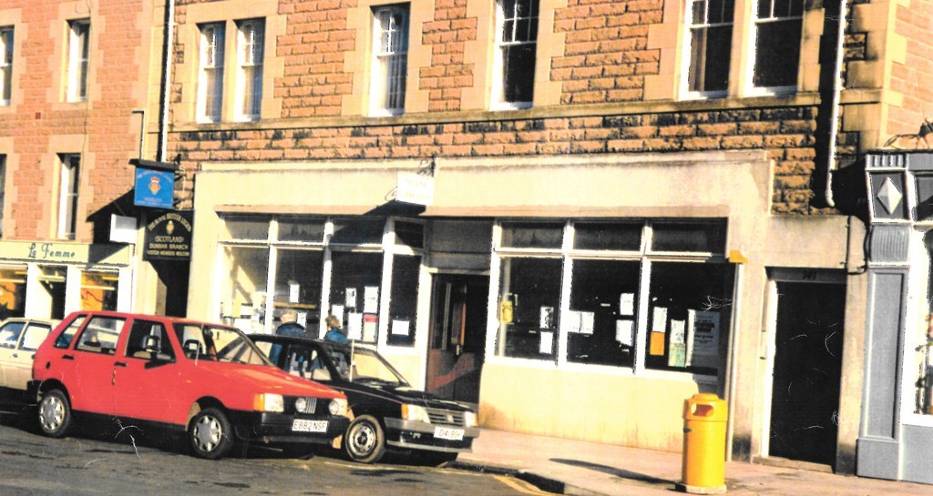
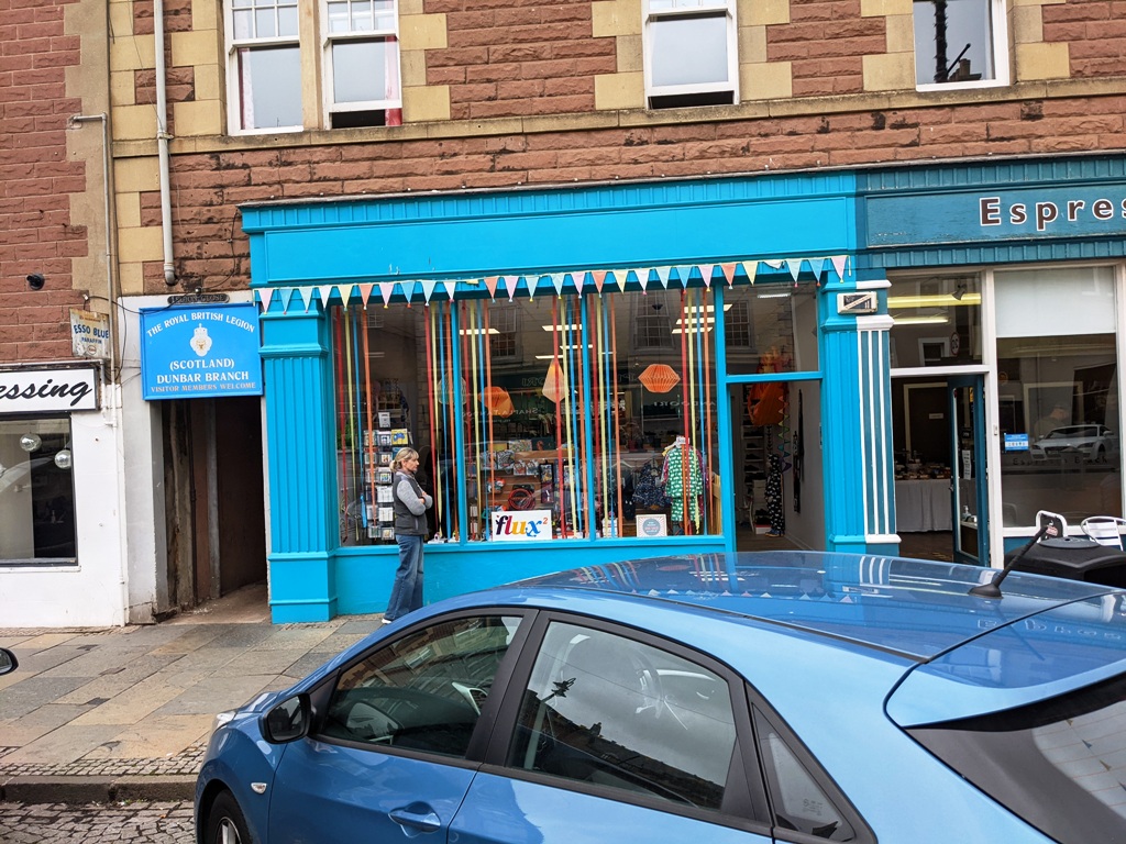
The first photo above shows the public toilets and cloakrooms in the High Street. Next to the toilets, you can see the signs for the Dunbar British Legion, the blue one jutting out and the black one above the entrance to the Legion Close leading to the Legion buildings. In today’s photo, there is only a blue sign above the entrance. The first photo may be from the 1960s and next to the cloakrooms was La Femme, which was a clothes shop managed by Janie Lister. The shop was very popular with women at the time as it stocked a range of fashinable women’s clothing. In today’s photo, the shop is now Lewis George hairdressers. In both photos, you can see that there is an old Esso Blue Paraffin sign, and this was part of Dickson’s the ironmongers shop. The toilets and cloakrooms came to the aid of many summer visitors in the 1950s and 1960s, especially when it rained and bus parties had to wait until a certain time to re-join their bus. To use these toilets, people had to put an old penny (1d) in the slot and this is thought to be the origin of the term “spend a penny”. It was also the origin of the well-known graffiti in the toilets, which began “Here I sit…”.

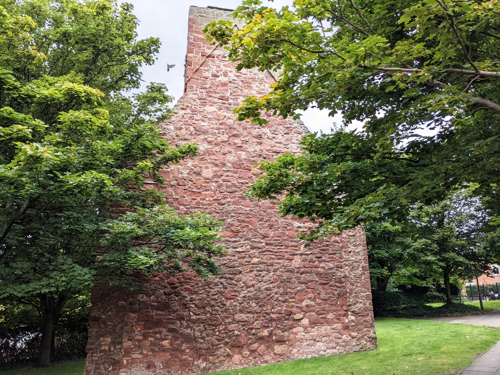

The first photo above shows the doocot at Friarscroft, which stands to the left of the main road opposite the western end of Delisle Street. This Camore site tells us that “The small house of Trinitarian or Red Friars at Dunbar is stated to have been ‘biggit and foundit’ by Cristiana de Brus, countess of Dunbar, this foundation probably taking place in 1240-8. The priory was dissolved in 1529”. The impressive building was originally a tower in the friary church which was 39m long by 8m wide, so it must have been an imposing presence in its day and it would have dominated all other, much smaller buildings around it. The Canmore site also refers to a cemetery to the south of the church and evidence of “medieval ploughing” to the north. To read more about the history of Friarscroft and of the excavations done there in 1981, see here. The photo is of course from much more modern times and Pauline Smeed commented “The buildings on the right are farm cottages with the horse mill, now converted and still there today on the corner by Friarscroft. The chimney and tank in the distance are the old gasworks, now Graham Place (named after Isa Graham). The long white building on the left before the Bleachingfield is the old washhouse. You can just see some washing on the line on the left side”. The first photo cannot be copied today because of the planting of trees, but the solid tower/doocot still stands as seen in the second photo. Third photo is taken from the car park of the houses at Friarscroft and you can clearly see the modernised horse mill building. The architectural structure of the horse mill is described in this Canmore site.
You must be logged in to post a comment.