This month and September 2019 will be devoted to maps of Dunbar at different times. For August, we will look at part of John Wood’s map of Dunbar which was published in 1830. Copies of the Wood map are on sale at the History Society and Tippicanoe in Dunbar HIgh Street and cost £4. There is a very good article on the origins of Wood’s map here. David Anderson has contributed to the notes below.

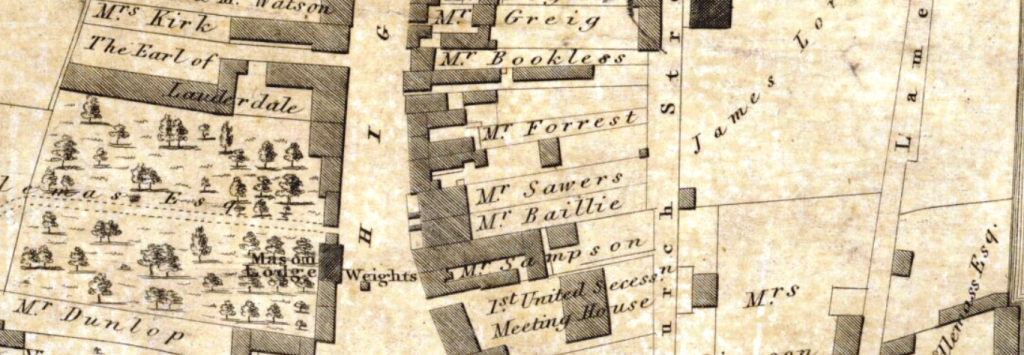
This part of the map looks at the eastern end of the High Street. Key features of this map are on the left hand side, the Masonic Lodge which was situated on the High Street next to what is now Douglas Reid’s showroom. You can read more about Dunbar Freemasons here. The tron or town weigh beam was originally outside (Weights marked). On the right hand side the 1st United Secession Meeting House is highlighted and the entrance to the church (aka meeting house) was from Church Street. Wood doesn’t seem to show the manse which was on the west side of the church. One very interesting feature of this map is that it shows that behind the left hand side of the High Street, it was mainly orchards and gardens.

The second extract from Wood’s map moves us up the High Street. On the right hand side of the map, we can see that James Lorimer owned a large section of land and this was called Sandwell Gardens, which were used as market gardens. The Assembly Rooms are clearly marked. This building was erected in 1822 for meetings of farmers around Dunbar and was used by George Low and Son in the mid 20th century for auctions. The historian James Miller mentions it being for civic receptions, celebrations, balls, etc on the back of the Napoleonic period. Also on the map is Crows Wynd, sometimes called Craws Wynd, which later became Cossars Wynd. We can also see that as we move up the High Street, the trees disappear from the left and are replaced, as on the right hand side, with small fields. There is also an increase in the extent of building on the right hand side. Also of note is the extent of land on the left hand side owned by the Reverend John Jaffray, who was minister of the Parish Church which was built a decade earlier.
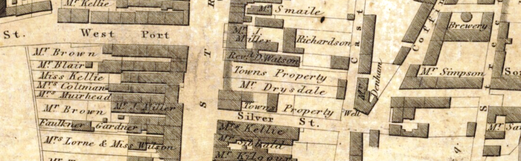
The final extract shows the middle of the High Street, with the West Port on the left and Silver Street on the right. At the bottom of Silver Street, diagonally opposite is Coffin Street, known today as Colvin Street. To the right of Coffin Street a brewery is marked and this was the Dunbar Brewery. The John Gray Centre has more information on this brewery and on the history of brewing in Dunbar – see here. On the left hand side going down Silver Street is property owned by the Town Council – this was the new town jail and the vacant lot at the bottom right was the site of the original gasworks. There is a well marked on Church Street.
You must be logged in to post a comment.